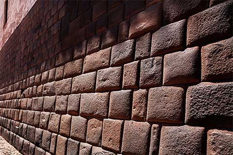
Peru
A country of fascinating cultures stretches over a territory with a diverse geography. Land of continuous discoveries with 12 sites on UNESCO’s World Heritage List, Peru is one of the cradles of ancient civilization dating back 5000 years, home to the oldest and most powerful empire in South America and a place where mythical beliefs are still alive. Renowned for its impressive cultural legacy, Peru is blessed with stunning natural wonders, being part of the select group of mega-diversified countries, an ecological treasure with several world records.

The country has three different zones: the coast bordering the Pacific Ocean with arid deserts and beaches; the Amazon rainforest covering almost two-thirds of the territory and the highlands with the majestic Andes. With a lot of good reasons to be a world’s top destination, this land of extremes possesses 84 of the 104 life zones existing on the planet.

Home to the mysterious Nasca Lines; the Amazon River; Titicaca, the highest navigable lake; one of the deepest canyons; an oasis in the desert and the Inca wonder of Machu Picchu among its wide range of attractions, this country has something for everyone. The warm nature of its people; archaeological sites; exquisite weavings; fine gold and silver artifacts or a superb world class cuisine influenced through the ages from Asia, Africa and Spain, just confirm the full spectrum of possibilities that Peru offers for the most discerning of travelers.
How to get there
Lima, the capital, is the gateway for international travelers. It has the most important airport in the country: Jorge Chavez International Airport, covering both international and domestic flights. There are direct flights from many cities in the United States, South and Central America and Europe; and connecting flights to other countries. Some visitors also arrive by cruises that include Peru in their itineraries and most of them arrive to Callao (Lima).
Lima
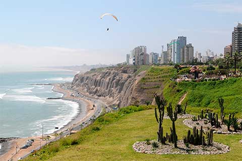
Altitude: sea level. Best time to visit: all year.
Peru’s capital is a sprawling, bustling and interesting city with more than 10 million inhabitants, about one third of the total population of the country. Ruled by viceroys and lordships, Lima was the main political, religious and administrative center of South America in colonial times. Monasteries, magnificent churches, squares and houses with fine wood carved balconies were built in this city that retains its legacy.
Its origins date back to millennia and archaeological sites as Pachacamac or the pre-Columbian “huacas”, religious buildings -some immersed in the middle of the large modern buildings-, are contained in this city of contrasts where a massive immigration from other Peruvian cities has created a new identity in constant evolution. Located on the shores of the Pacific Ocean, excellent museums, malls, markets, adventure sports and nightlife are all part of this exciting metropolis.


Rich of flavors, this city is the Gastronomic Capital of South America. The several markets of this top-ranked destination for foodies make up an attractive world of their own, full of splendid supplies ranging from exotic fruits, vegetables, grains, meat and poultry, spices and rare food gems to the freshest catch. Its wide range of fine restaurants, some of them among the world’s 50 best ones, make the dynamic Lima the ideal place for tasting the diverse and delicious Peruvian food.
How to get there
Lima is the gateway for international travelers and it has the most important airport in the country: Jorge Chavez International Airport, covering both international and domestic flights. There are direct flights from many cities in the United States, South and Central America and Europe; and connecting flights to other countries. Some visitors also arrive by cruises that include Peru in their itineraries and most of them arrive to Callao (Lima).
Cusco, Sacred Valley and Machu Picchu
Arequipa and Colca Canyon
Altitude: 2,325m/7,628ft. Best season to visit: March to December.
Surrounded by towering volcanoes and snow-capped mountains, Arequipa is the second largest city of the country and it preserves one of its best architectural colonial treasures. The combination of European and native building techniques resulted in beautiful master monuments made in sillar -white volcanic stone- and there are many convents, temples and mansions of the mestizo baroque-style. The colonial city dates to 1540 and its historical center is a World Heritage site.
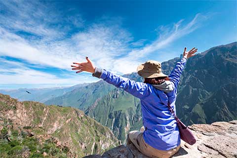
The Santa Catalina Convent, used as a cloister for two centuries, is one of its main attractions. The Cathedral, the cloisters of La Compañía and the old Jesuit church, are other important religious buildings. Its peaceful and green countryside also host colonial monuments as the Founder’s Mansion and the Sabandia Mill, has lookouts to enjoy views of the so called “white city” because of its architecture, and the great Arequipa’s cuisine can be delighted at its typical “picanterias”. Just a few hours away, the valley and the Colca Canyon are an inviting destination.

Colca Valley is an area of astounding scenic beauty with pre-Hispanic agricultural terraces performing an incredible landscape. The inhabitants in its fourteen villages wear colorful costumes, each community has a distinctive hat that defines their ethnicity, and have managed to preserve their lovely 16th century colonial churches with Baroque interiors. Colca Canyon, one of the deepest in the world, is a natural observation point for the flight of the majestic Andean Condor.
How to get there
Arequipa is easily reached by air from Lima (1.5 hours) and Cusco and Puno (Juliaca) in 1hour, among other cities. It is connected by bus to Lima, Cusco, Nasca (10 hour) and Puno (7 hour), and it is also linked to Cusco and Puno by the luxury sleeper train Belmond Andean Explorer, in impresive journeys. Colca Valley –usually visited in conjunction with Arequipa´s city- is just 4 hours away and, from Colca, the land journey to Puno takes 5-6 hour.
Puno and Lake Titicaca
Altitude: 3,800m/12,550ft. Best season to visit: March to December.
The beautiful and much venerated Lake Titicaca, lies on the border of Peru and Bolivia with more than half of its surface in Peruvian territory. Thought to be there million years old and overflowing of life, the presence of the highest navigable lake in the world has marked the life of the inhabitants of the highlands. Puno is a region of contrasts and well-preserved living traditions that attracts one where the history and the ancestral customs are part of the quiet landscape of the Puna.

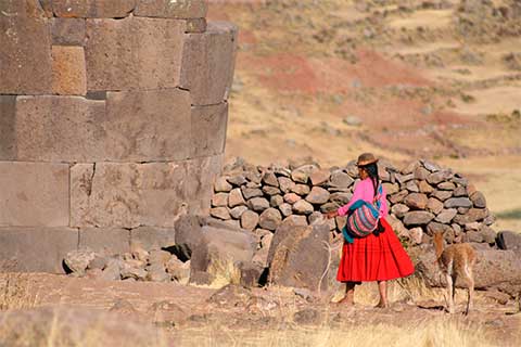
Countless archaeological remains, tombs built above ground in tower-like structures, several and unique colonial churches with a distinctive architecture and interiors of a high artistic quality; populations where even the children are masters in weaving techniques, great celebrations and natural and singular artificial islands, all inhabited by ancient communities that welcome visitors to stay in their homes, show a side of Peru from a bygone era.
In February, this land known as the folkloric capital of the country celebrates -more than two weeks- the biggest festivity of Peru: Virgin of Candelaria Feast. With a syncretism of two different cultures and religions, thousands of dancers and musicians gather to be part of this significant event, an intangible Cultural Heritage of Humanity.
How to get there
The closest airport is in Juliaca (1 hour away) serving domestic flights from Lima, Arequipa and Cusco. A train route awarded as one of the most beautiful in the world connects Puno and Cusco. This route is also made by Belmond Andean Explorer luxury sleeper train with the possibility to continue to Arequipa on a three-day journey. Bus ride from Arequipa takes 7 hours and from Cusco 7-10 depending on stops en route. Modern yachts and catamarans cross Lake Titicaca and connect Puno and Bolivia, also linked with buses and medium crafts.
Paracas - Ica - Nasca
Altitudes: Paracas: sea level/ Ica: 400m/1,300ft. Nasca: 520m/1,700ft / Best time to visit: all year.

South of Lima (260km/161mi) the Paracas Peninsula has one of the largest marine reserves in the country: The Paracas National Reserve, which covers 335,000 hectares. Ballestas Islands are located off the coastal town, and are home to big colonies of sea lions, birds such as cormorants, pelicans, gulls and tendrils. The Humboldt penguin, the only species of penguin of the country, also live there and all of them help to create the massive layers of guano that covers these islands.
The valley of Ica, just one-hour ride from Paracas, is the cradle of Peru’s wine and Pisco -the national drink- production. The wineries are located in the peaceful countryside and many of the small ones still produce using ancient techniques. Long inhabited by different cultures, this land of healers and saints is also home of the beautiful Huacachina oasis. Taking an exciting buggy ride full of adrenaline in the near desert dunes is perfect for adventurers.


Nasca, 450 km (279mi) south of Lima, comprises one of the great mysteries of mankind. Spread over 500 sq km/310 sq mi, perfectly drawn in the sands of one of the most arid areas of the world over 2000 years ago, lie huge figures and geoglyphs as a bird, a lizard and a spider, among others, ranging from 50 to 1200 feet in length (300m). Astronomical Calendar, an offering to the gods or other possible significance of these lines only visible from the air still remains an enigma.
The ancient cultures of the coast reached an unsuspected degree of development and left us significant works as the Cantalloc Aqueducts -made to survive in the desert- with clever irrigation channels still used by local farmers for water supply. Another important finding is the Chauchilla Cemetery and its remarkably preserved pre-Hispanic mummies and artifacts that provide an important insight into the lives of its inhabitants.
How to get there
Paracas, Ica and Nasca are easily reached from Lima by land. Paracas coastal town -usually the base to visit this region-, is located 3 hours by car from Lima. One more hour following the Panamerican highway drives to Ica city and another 2.5 hour trip from Ica leads to Nazca. Pisco airport (20 minutes away Paracas) is one of the three airports used for taking the scenic flights over the Nasca Lines (The other two are in Ica and in Nasca town). A 10-hour ride from Nasca takes to Arequipa, and a 6-hours ride from Ica takes to the Andean town of Ayacucho.
Tambopata - Manu
Tambopata
Altitude: 250m/820ft. Best season to visit: March to December.
In southeastern Peru, the stunning Tambopata National Reserve is one of the earth’s largest biodiversity habitats with 274,690 ha (1,061 sq miles) of preserved land. Holding several records of flora and fauna and many different ecosystems, its healthy environment helps to recover and protect species.

Spectacular waterfalls, rivers with white sand beaches and pristine lakes are located in this area that contains one of the world’s largest mineral clay clicks.
This big territory harbors some of the least impacted habitats in the world, and it is a spot where scientists continue to discover new species. Over 1200 butterfly species, 600 bird species, more than 150 mammals and hundreds of species of trees and plants live there. Giant river otters and the strange hoatzin, are part of its amazing fauna and nature offers a great spectacle when hundreds of parrots and macaws congregate at dawn to feed at the clay lick.

Manu
Altitude: 150m to puna elevations of 4200m. Best time to visit: May to October.
Manu National Park is a Natural World Heritage Site by UNESCO. Biosphere Reserve. With a vast territory of 1.8-million-hectare, it is one of the largest rainforest reserve. The natural habitat of the national bird, Cock of the Rock, it has an incredible range of wildlife and, according to many biologists, it possesses the most diverse concentration of flora and fauna on the planet.


Rare species as the Spectacled Bear (South America’s only bear) and some 221 different mammals find its refuge in this heavenly paradise for birdwatchers that houses more than 1300 species of birds (over 10% of the world’s total). This park is home to a wide variety of ecosystems, ranging from the frigid Andean plains to the Amazon rainforest, and it is home to indigenous populations that have different levels of contact with the outside world.
How to get to Tambopata
Puerto Maldonado city in Madre de Dios department is the gateway to Tambopata National Reserve. There are several flights from Lima (2-3 hours, most of them with a stop in Cusco) and from Cusco (1 hour). Once there, a land and boat transfer take visitors to their selected jungle lodge within the reserve or on the outskirts.
How to get to Manu
There are two ways to arrive to Manu: from Puerto Maldonado and from Cusco, the most frequently used access as it allows visitors to see the entire range of habitats within the reserve descending from the highlands to the jungle, passing by spectacular cloud forests until reaching the lowlands.
Trujillo and Chiclayo
Altitude: sea level. Best season to visit: all year.
In northern Peru, traces of the past are always being discovered. The impressive Moche civilization came to a single development and dominated the country’s northern coast from 100 to 800 AD. The Tomb of the Lord of Sipan was one of the greatest archaeological discovery of the twentieth century in America. Found close to Chiclayo, it contained exquisite pieces made of gold, silver and copper, wood; ceramics and other objects of immeasurable value.

Trujillo is home to Chan Chan, one of the world’s largest cities built out of adobe covering 7720 sq miles (20 sq km), and it is an invaluable testimony of another great pre-Hispanic civilization, the Chimu Culture. In the same region, the Huaca of the Sun -a scaled pyramidal building measuring more than 40m in height- and the Huaca of the Moon, are Moche ceremonial centers and place of human sacrifices. In Huanchaco Beach, the pre-Hispanic boats known as “caballitos de totora” are still used by the fishermen and not far away, Trujillo’s historical center shows a rich monumental heritage with mansions and churches of the colonial era. These northern regions have a long-standing tradition of shamanism and sorcery.

Between Chiclayo and Trujillo, “El Brujo” (shaman or witch) is an archaeological complex occupied since pre-ceramic times. This complex exhibits decorated walls with graphic depictions of supernatural beings, feline and fish figures, among others. The legendary Lady of Cao (about 450 CE), a mummified priestess and a recent significant finding in Peruvian history, is well preserved in its site museum. Enormous cities, mausoleums, temples and pyramids of these areas yet revealing treasures, are to discover the advanced development of ancient civilizations that flourished there long before the time of the Incas.
How to get there
Chiclayo and Trujillo are connected by air to Lima in one hour approx, also by bus in 8 hours. These two cities are located some 200 km/124 mi and the car ride takes around 3.5 hours. They are also connected by road to other cities as Cajamarca (7 hours) and Chachapoyas (10 hours).
Iquitos, the Amazon River and Pacaya Samiria
Altitude: 104m/341ftl. Best season to visit: April to October.
Iquitos, isolated from the rest of the world by the lush rainforest, is the capital of the vast Loreto region. This city, linked to the outside world only by air and by the river, showcases traces left over from the thousands of Europeans who lived there during the rubber boom in the late 19th century. Historic buildings, the singular shanty town of Belen and the coexistence with native communities are all part of this city, gateway to some of the top national parks and reserves.
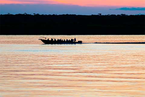

Covering 2,080,000ha and hosting over one third of all the species existing in the Amazon rainforest, Pacaya Samiria is the most extensive protected flooded forest area. The cycle of the crescent and reflux of the rivers is an essential characteristic of this stunning habitat inhabited by perfectly adapted monkeys, sloths, iconic pink river dolphins, large mammals, an extraordinary diversity of freshwater aquatic species and more than 800 of trees among other records.
Containing one of the most intact forest in the world, Loreto is one of the most sparsely populated regions due to its remote location and there, riding in small canoes by the mighty Amazon River -the longest in the world- and its tributaries, lead to territories that have changed little or nothing in thousand years. Hosting over half the world’s species, the rainforest cover only 6% of the land surface of the planet and regions like Loreto, a true paradise for ecological conservation, wildlife viewing and natural beauty with a stunning biodiversity, are to understand why it has called explorers for centuries.
How to get there
Iquitos is the gateway to Loreto region. It is possible to arrive by air only, or by the river. There are frequent flights from Lima (1.30 hours) and from other Peruvian jungle cities as Pucallpa (1 hour) and Tarapoto (1 hour), as well as international flights to Panama, a hub to connect with the rest of the world. River voyages from Pucallpa may take even a week sailing by the Ucayali River. With an array of itineraries, cruises by the Amazon River take 4 to 8 days, some of them travel to Pacaya Samiria National Reserve and other to the border with Colombia and Brazil.
Caral
Altitude: 350m/1,148ft. Best season to visit: all year. Light rain between June and September.
Located on a desert plateau in the Supe Valley almost 125 miles/220 km north of Lima and developed nearly 5000 years ago, Caral is one of the world´s earliest large cities, contemporary with China and Babylon at its greatest. One of 18 urban settlements identified in the area, this city covered more than 60 hectares and its extraordinary preserved complex and monumental stone architecture include altars, six large pyramidal structures, sunken circular plazas and amphitheaters.
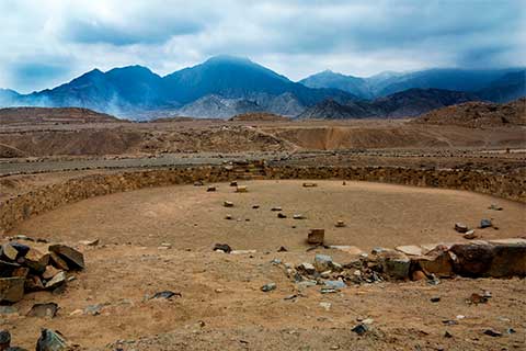
The people of Caral-Supe achieved a high acknowledgement of agricultural techniques, produced weapons and musical instruments, knew about natural medicine, and elaborated the oldest “quipu” of the world. Quipu was a method used by the ancient civilizations consisting in a rope system with many knots and colors to record and communicate information in the absence of an alphabetic writing system. Evidence to clarify why this city, the oldest centre of civilization in the America´s was abandoned, has not yet been found. Caral is known as a sacred city because all the excavations performed reveal ceremonial functions and a strong religious ideology, and the complexity of this culture has turned academic thinking upside down, since it is an evidence of a state existing in the pre-ceramic era.
How to get there
The easiest way to get to Caral is traveling from Lima by private car in around two and a half hours. Local buses go north on the Pan-American Highway to Supe and once there, another transportation is required to arrive to the archaeological site. It is also possible to travel by land from Trujillo (6-7 hours), Chiclayo and other northern cities.
Chachapoyas
Altitude: 2,330m/1148ft. Some archaeological remains altitude is 3,000m/9,843ft.
Chachapoyas, a still off the beaten path destination in northern Peru, contains significant pre-Inca remains, many of them still hidden beneath the undergrowth. A unique natural environment with high mountains and rainforest is found in this remote place, cradle of the ancient Chachapoya Culture which ruled over a large area of this region. Ancestrally inhabited by Andean people living in the cloud forests, this was the land of the enigmatic and fierce “Cloud Warriors”.

A trip into history leads to the imposing fortified city of Kuelap, built on a ridge overlooking a green valley with some walls rising up to 20m (65ft) in height. Also called “the Machu Picchu of the North”, it comprises more than four-hundred circular houses among other structures, some of them showing decorated friezes. The only entrances into this intriguing place that was protected by the nature for millennia, are three narrow gates that get narrower as you continue to enter.
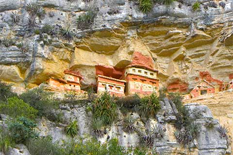
The cult of the dead was of great importance for the Chachapoya and their elaborate funerary architecture can be appreciated in the Sarcophagi of Karajia, located in a high and inaccessible location. Each one of the sarcophagi were designed to bury an individual mummy in fetal position, facing forward to the sunrise and close to the water. Also built high into limestone cliffs, the fascinating funerary complex of Revash looks like miniature villages and the height of the houses, 1 meter approx adapting to the space in the cave where they are located, is tall enough to host a mummified body in a sitting position. One of the natural gifts of the area is the Gocta Waterfall, the third-tallest world’s leaping waterfall, well known by Peruvians for centuries, but unknown for the rest of the world until 2002. Much research is yet to be done in this beautiful area of many stunning archaeological remains.
How to get there
Several gateways to get there include Chachapoyas, Jaen, Cajamarca, Tarapoto and Chiclayo airports, and there are direct flights from Lima (1.30 hours). Chachapoyas and Jaen are the closest airports, and Jaen is the easiest access. Once there, a three-hour land transfer leads to the most frequently used base to explore the area. Cities as Cajamarca and Chiclayo are connected by land in 7-10 hours.
Northen Beaches
The northern Peruvian shores have beautiful beaches bordering the Pacific Ocean, and the fishing cove of Mancora is one of its great spots. This nice and small friendly town, located more than 1000 km away from the capital, has a lively atmosphere and a spectacular seafood. The waters of the sea may not be as blue as the Caribbean, but this enchanting year-round sunny coast with sandy beaches offers natural and authentic not yet crowded destination.

Beaches with good waves make Mancora a world’s top surfing destination, but it also has beaches with a calm sea. Outdoor activities include whale watching, snorkeling, paddle boarding, horseback riding along the beach front and much more, and winds are great for kitesurfing. After visiting the several attractions of the country, a few relaxing days in this area with excellent beach resorts are the perfect culmination of an ideal travel.
How to get there
Several gateways include Tumbes, Talara and Piura with flights from Lima (1.5 hour flight approx). Tumbes is the closest airport (1.5 hours by road to Mancora) followed by Talara (2 hours) and Piura (3 hours). The border with Ecuador is very close (5 hours drive).
